
Cities can be very efficient: people live close together, share pipes and trains, and walk to many places. They can also be very wasteful. This topic covers the environmental challenges cities face and the ways they respond.
The challenges
- Sprawl. Low-density growth paves farmland and forest, lengthens car trips and stretches pipes and roads thin. Each new household at the edge costs more to serve.
- Sanitation. When a city grows faster than its sewers, untreated waste reaches rivers and wells. In many fast-growing cities, squatter settlements are the last to get sewers, so disease spreads most where people are poorest.
- Air quality. Cars, trucks, factories, power plants and burning waste foul city air. Delhi, India, suffers heavy smog most winters; studies blame traffic, industry, dust and crop burning in nearby states, with calm, cool air trapping the haze.
- Water quality and runoff. Roofs, roads and parking lots stop rain from soaking in. Water rushes off, carrying oil and trash into rivers and causing floods.
- Energy use. Heating, cooling, lighting and transport all use energy. Spread-out cities use more fuel per person for transport than compact cities with good transit.
- Climate change. Cities add greenhouse gases and feel the effects. Pavement and buildings soak up heat, so a city can be several degrees warmer than the countryside around it, an urban heat island. Coastal cities face rising seas. Jakarta, Indonesia, faces both rising seas and sinking land, because wells have pumped so much water from under it. In 2022, Indonesia passed a law to build a new capital, Nusantara, on the island of Borneo, citing Jakarta's crowding and sinking among its reasons.
The ecological footprint
A city's ecological footprint is the area of productive land and water needed to grow its food, supply its water, wood and energy, and absorb its waste and carbon dioxide. The Global Footprint Network measures footprints in "global hectares". A large city's footprint is many times larger than its own area, because its food comes from farms far away and its emissions spread across the planet. Footprints are larger where people consume more, so at the global scale, residents of high-income cities usually have larger footprints than residents of low-income cities.
Responses
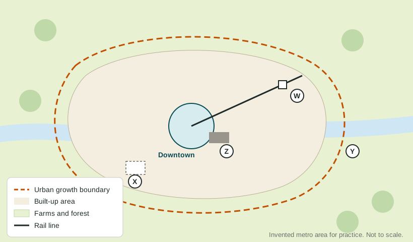
Brownfield cleanup. A brownfield is an abandoned or underused industrial or commercial site, such as an old factory, rail yard or gas station, whose reuse is held back by real or suspected pollution. Cleaning it up costs money, but it removes a health risk and lets the city grow on land it already has, near existing roads and pipes. The US Environmental Protection Agency gives grants to clean up brownfields. London's Queen Elizabeth Olympic Park, built for the 2012 Games, turned polluted industrial land in the Lea Valley into a park, sports venues and housing. In Pittsburgh, Pennsylvania, former steel mill sites along the rivers have become offices, shops and homes.
Urban growth boundaries and farmland protection. Growth boundaries keep building inside a line. Many counties also protect farmland by buying the right to develop it from farmers, who keep farming while the land stays open for good.
Regional planning. Pollution, traffic and rivers cross city limits, but local governments are fragmented. Regional bodies help. The Metropolitan Council of the Minneapolis-St. Paul region, created by Minnesota in 1967, plans sewers, transit and growth for its whole seven-county area. Metro, the elected regional government of the Portland, Oregon, area, manages its growth boundary.
Greener building and transport. Cities plant trees and green roofs to cool heat islands, add rain gardens that soak up runoff, build transit and bike lanes, and set rules for cleaner engines and buildings.
Trade-offs
| Response | Benefit | Cost or criticism |
|---|---|---|
| Brownfield cleanup | Removes pollution; reuses land near services | Expensive; new projects may raise nearby rents |
| Urban growth boundary | Protects farmland; supports transit | Can raise land and home prices |
| Farmland protection | Keeps local farms and open space | Costs public money; limits owners' choices |
| Regional planning | Plans across city limits | Local governments may resist losing control |