
Geographers ask questions about places: where things are, why they are there, and how people live with them. To answer, they need geographic data: information tied to a location. A list of ages is just data; a list of ages for each neighborhood of Chicago is geographic data, because each number belongs to a place.
Two kinds of data
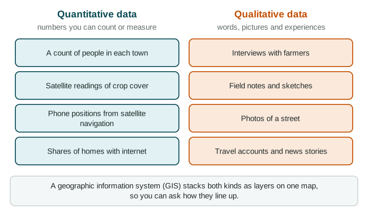
Quantitative data are numbers you can count or measure: the number of stalls on a market street, the yearly rainfall in Mumbai, the share of homes with internet in a province. They are good for questions that begin "how many", "how much" or "where".
Qualitative data are words, pictures and experiences: interviews, field notes, photos, travel accounts, news stories and government policy documents. They are good for questions that begin "why", "how do people feel" or "what is it like".
| Quantitative | Qualitative | |
|---|---|---|
| Form | Numbers | Words and pictures |
| Examples | Counts, measurements, satellite readings, positions | Interviews, field notes, photos, diaries, news, policy documents |
| Strength | Easy to compare places and dates | Shows reasons, feelings and meaning |
| Weakness | Shows what, not why | Shaped by who recorded it; hard to compare |
Field observation
Field observation means going to the place: walking a street, counting, sketching, photographing and talking to people. Organizations do it on a large scale (a ministry counting farms, a charity surveying a camp for families who lost their homes in a flood) and so do individual researchers. Field notes from a market street in a capital city might record 42 stalls (quantitative) and why two owners moved there (qualitative). The weakness: field data cover one place at one time. A Saturday morning visit says little about weekday evenings.
Tools that work from a distance
Remote sensing gathers data about the Earth from far away, usually by satellites or aircraft that record images or light. Brazil's space research agency uses satellite images to measure how much of the Amazon rainforest is cleared each year, because no field team could cover the whole forest the same way every year. Satellites also record lights at night, a clue to where people and electricity are. Remote sensing shows what changed and where, not why.
A satellite navigation system, such as the United States' GPS, uses signals from satellites to find the exact location of a receiver. Phones, delivery trucks and farm machines use it, and the positions they record become data too.
Online maps and mapping apps let anyone view, and sometimes add, geographic data. Many cities post maps of bike lanes, bus routes or building permits.
Putting data together: GIS
A geographic information system (GIS) is software that stores data as layers tied to locations: roads in one layer, clinics in another, flood-prone streets in a third. Stacking the layers answers questions about where things meet. A geographer studying a neighborhood in Lagos, Nigeria, could overlay flood-prone streets and clinics to find which clinics may be hard to reach in the rainy season.